Working Group 3 on Integrating Geospatial Information and Statistics aims to integrate statistic and spatial data to monitor targets and indicators of Sustainable Development Goals (SDGs).
Working Group Chair
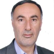
Mr. Seyed Eskandar Seydayei
Islamic Republic of Iran
Director General
National Cartographic Center
Working Group Vice-Chairs
Mr. Hidenori Fujimura
Japan
Director, Planning Division, Geospatial Information Department
Geospatial Information Authority of Japan
Sr Siti Zainun binti Mohamad
Malaysia
Divisional Director of Survey, National Geospatial Database Division
Department of Survey and Mapping Malaysia
Ms. Bayarmaa Enkhtur
Mongolia
Head, Geospatial Information and Technology Department
Agency for Land Administration and Management, Geodesy and Cartography (ALAMGC)
Mr. Jeon Bu-nam
Republic of Korea (the)
Deputy Director, National Geographic Data Monitoring Department
National Geographic Information Institute
Ministry of Land, Infrastructure and Transport


