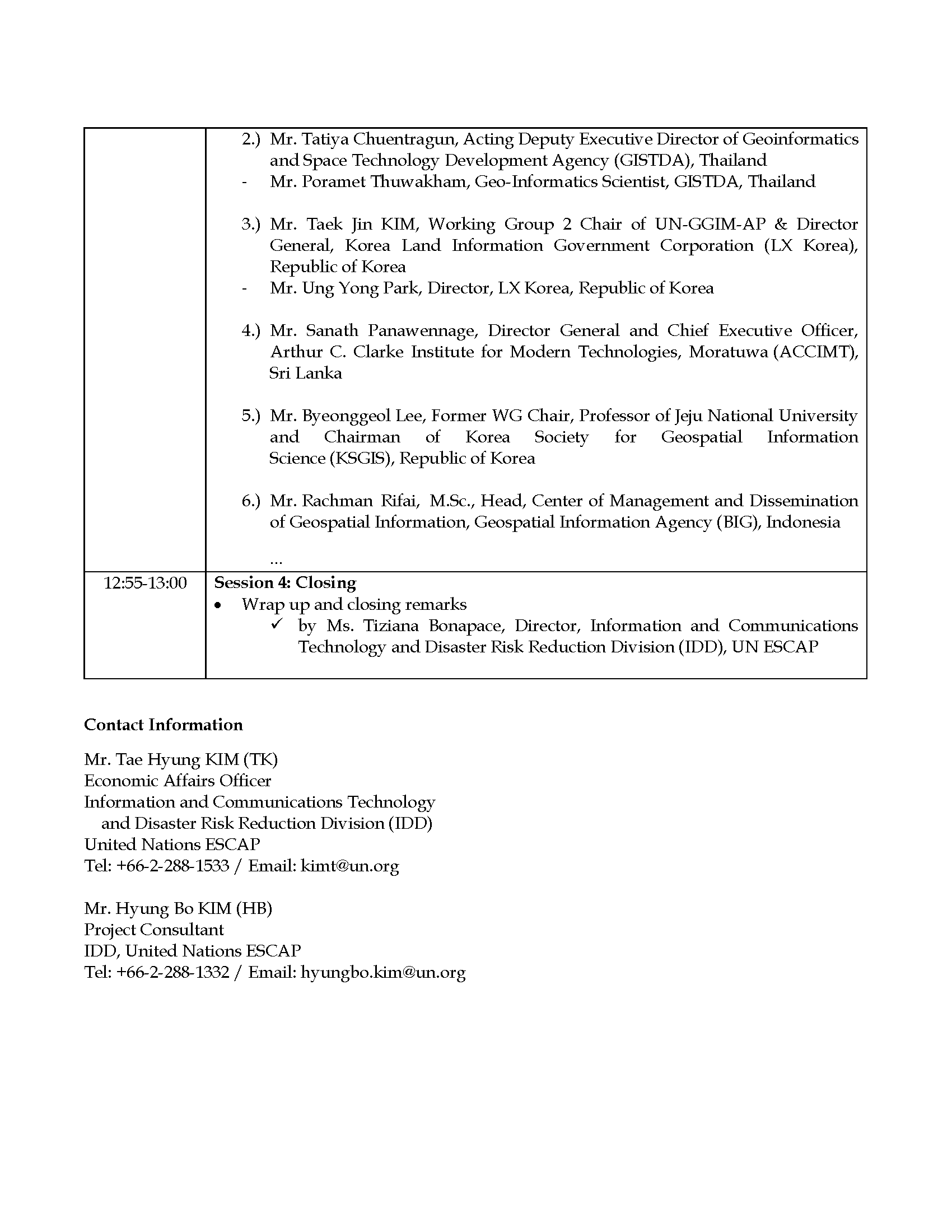
Regional Workshop for Promoting the Asia-Pacific Geospatial Information Platform
(Virtual Meeting)
16 Okt 2020, 10:00 - 13:00 (UTC+7, Bangkok time)
By Invitation Only
Integrating geospatial data, existing statistics and ground-based information and exploiting new data sources, analytics, processes and tools has proven instrumental to deliver timely and authoritative information necessary for governments, businesses, communities and citizens to take action and make evidenced-based decisions. It is also a vital asset to provide far-reaching solutions to pressing issues facing humanity, ranging from health – and notably the COVID-19 pandemic – education, food security, agriculture, energy, to disaster risk reduction and building resilience.
Key challenges remain in efficient and effective use of geospatial information: data is (1) scattered among data holders, data users, and sub-regional networks at the country / sub-regional levels; (2) data is not open, shared, sometimes partial, and managed by various ministries/sectors that do not connect properly to each other; (3) data is not managed by a leading organization to integrate regional data stakeholders, platforms and data network under one umbrella in the Asia Pacific region; and (4) no guidance through a regional intergovernmental agreement or framework arrangement that sets out the scope, benefits and responsibility of regional data integration and provides a clear mandate that promotes networked and integrated geospatial information in the region.
In this connection, ESCAP, as the Secretariat of UN-GGIM-AP has initiated a long-term initiative over the next 10 years from 2020 to 2030 to provide member States with an integrated geospatial data hub through the operation of an Asia-Pacific geospatial information platform across countries.

