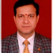
Prakash Joshi is the Director General of Survey Department, Government of Nepal which is the National Mapping Agency (NMA) of Nepal. As a head of NMA, Mr. Joshi is dedicated on policy formulation in the field of surveying and mapping, developing specifications and standards for mapping activities conducted by all other agencies. He has been serving Government of Nepal for 18 years in the field of surveying, mapping and geoinformation.
During his tenure as Director General, he successfully conducted joint announcement of height of Sagarmatha, completed preparation of local level land use data for supporting land use plan implementation at local level, conducted LiDAR survey at the western part of the country, implemented central server-based LIS termed as Nepal Land Information System (NeLIS) for service delivery at district survey offices and also established national geoportal to share the geoinformation. In this regard, he is dedicated in modernizing the surveying and mapping activities in the country.
Prakash has been awarded with “Nepal Bidhya Bhushan ‘Kha’” from the Government of Nepal for achieving the highest position in the land administration faculty during MSC in ITC Netherlands, Certificate of appreciation for successful conduction of Sagarmatha height measurement, Best Civil Service award on the occasion of civil service day and Suprawal Jana Sewa Shree, 3rd Medal on the occasion of Constitution Day from the government of Nepal.
Prakash holds MSC degree form Faculty of Geoinformation Science and Earth Observation (ITC), University of Twente and also MA degree in Geography from Tribhuvan University, Nepal.
